
Amazon Prime Free Trial
FREE Delivery is available to Prime members. To join, select "Try Amazon Prime and start saving today with FREE Delivery" below the Add to Cart button and confirm your Prime free trial.
Amazon Prime members enjoy:- Cardmembers earn 5% Back at Amazon.com with a Prime Credit Card.
- Unlimited FREE Prime delivery
- Streaming of thousands of movies and TV shows with limited ads on Prime Video.
- A Kindle book to borrow for free each month - with no due dates
- Listen to over 2 million songs and hundreds of playlists
Important: Your credit card will NOT be charged when you start your free trial or if you cancel during the trial period. If you're happy with Amazon Prime, do nothing. At the end of the free trial, your membership will automatically upgrade to a monthly membership.
Buy new:
$14.95$14.95
Ships from: Amazon.com Sold by: Amazon.com
Save with Used - Good
$5.99$5.99
$3.99 delivery March 28 - April 3
Ships from: HPB Inc. Sold by: HPB Inc.

Download the free Kindle app and start reading Kindle books instantly on your smartphone, tablet, or computer - no Kindle device required.
Read instantly on your browser with Kindle for Web.
Using your mobile phone camera - scan the code below and download the Kindle app.
Follow the author
OK
Santa Fe, Truchas Peak Map (National Geographic Trails Illustrated Map, 731) Map – Folded Map, January 1, 2019
Purchase options and add-ons
• Waterproof • Tear-Resistant • Topographic Map
National Geographic's Trails Illustrated map of the Truchas Peak and Santa Fe was designed for all outdoor enthusiasts enjoying the recreational opportunities around Santa Fe. Expertly researched and created in cooperation with the U.S. Forest Service and others, the map covers the area's wide range of public recreation lands with unparalleled detail. Coverage includes Santa Fe and Carson National Forests; Pecos Wilderness, River and National Historical Park; Picuris, Nambe, Tesuque Pueblos; Morphy Lake and Hyde Memorial State Parks; Santa Fe Canyon Preserve; and Open Space Parks.
Get off the beaten bath and back on again by following the map along clearly mapped trails, shown with mileage markers and colored for motorized or non-motorized use, including the area's National Recreation Trails. Your navigation will be aided by the map's contour lines, elevations, labeled peaks and summits, water features, numbered Forest Service roads and clear color-coded boundaries for different land designations. Those preferring to explore by road will find the El Camino Real, Santa Fe Trail, Historic Route 66 and High Road to Taos Scenic Byways, all shown with their roadside points of interest. Other recreation features include trailheads, interpretive trails, campgrounds, RV campgrounds and dump stations, cross-country ski trails, alpine ski areas, boat ramps, canoe and fishing areas, lookout towers and scenic viewpoints.
Every Trails Illustrated map is printed on "Backcountry Tough" waterproof, tear-resistant paper. A full UTM grid is printed on the map to aid with GPS navigation.
Other features found on this map include: Carson National Forest, Pecos National Historical Park, Pecos Wilderness, Rincon Mountains, Santa Fe, Santa Fe Baldy, Santa Fe National Forest, Truchas Peak.
- Map Scale = 1:63,360
- Sheet Size = 37.75" x 25.5"
- Folded Size = 4.25" x 9.25"
- Print length2 pages
- LanguageEnglish
- PublisherNatl Geographic Society Maps
- Publication dateJanuary 1, 2019
- Dimensions4.25 x 0.1 x 9.25 inches
- ISBN-101566956773
- ISBN-13978-1566956772
Book recommendations, author interviews, editors' picks, and more. Read it now.
Frequently bought together

Frequently purchased items with fast delivery
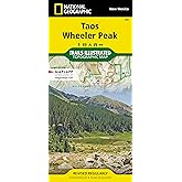
- Taos, Wheeler Peak Map (National Geographic Trails Illustrated Map, 730)National Geographic Maps - Trails IllustratedMap
- Mount Whitney Map (National Geographic Trails Illustrated Map, 322)National Geographic Maps - Trails IllustratedMap
- Indian Peaks, Gold Hill (National Geographic Trails Illustrated Map) (National Geographic Trails Illustrated Map, 102)National Geographic Maps - Trails IllustratedMap
- Mount Rainier National Park Map (National Geographic Trails Illustrated Map, 217)National Geographic Maps - Trails IllustratedMap
- Pikes Peak, Cañon City Map (National Geographic Trails Illustrated Map, 137)National Geographic Maps - Trails IllustratedMap
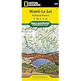
- Manti-La Sal National Forest Map (National Geographic Trails Illustrated Map, 703)National Geographic Maps - Trails IllustratedMap
Editorial Reviews
About the Author
Product details
- Publisher : Natl Geographic Society Maps; 2019th edition (January 1, 2019)
- Language : English
- Map : 2 pages
- ISBN-10 : 1566956773
- ISBN-13 : 978-1566956772
- Item Weight : 3.21 ounces
- Dimensions : 4.25 x 0.1 x 9.25 inches
- Best Sellers Rank: #224,091 in Books (See Top 100 in Books)
- Customer Reviews:
About the author

Founded in 1915 as the Map Department of the National Geographic Society, National Geographic Maps is responsible for illustrating the world around us through the art and science of mapmaking. Today, National Geographic Maps continues this mission by creating the world’s best wall maps, outdoor recreation maps, travel maps, atlases and globes that inspire people to care about and explore their world. Our team of cartographers, editors, producers, and salespeople is located in Washington, DC and Evergreen, Colorado.
National Geographic wall maps offer special glimpses into current and historical events, and inform map readers about our world and our environment. Offered in a variety of styles and formats, our maps of the world, continents, countries, regions, history, nature, and space are all excellent reference tools that make a perfect addition to any home, office, or school. National Geographic wall maps are printed on high-quality paper and are suitable for framing.
Styles:
Classic: Bright, easy-to-read color palette
Executive: Antique-style color palette
Decorator: Vibrant color palette
Modern: Unique, nontraditional color palette
Customer reviews
Customer Reviews, including Product Star Ratings help customers to learn more about the product and decide whether it is the right product for them.
To calculate the overall star rating and percentage breakdown by star, we don’t use a simple average. Instead, our system considers things like how recent a review is and if the reviewer bought the item on Amazon. It also analyzed reviews to verify trustworthiness.
Learn more how customers reviews work on AmazonTop reviews from the United States
There was a problem filtering reviews. Please reload the page.
- Reviewed in the United States on February 9, 2025Planning a hiking trip to Trampas Lakes and this map is just what we needed.
- Reviewed in the United States on October 23, 2024Very good map of the area. Some trails are missing but mostly a very accurate map, and a good scale (63,360 - one inch per mile). We ended up using the Outdoor Trail Maps one more because it was smaller and easier to handle. But if you want a wider area that includes part of Santa Fe, this is a solid map.
- Reviewed in the United States on August 23, 2024I have been in situations where being off the grid includes severally reduced satellite service, too. These maps are quality, accurate and weather resistant. I have practically run them through the wringer and had them still in great condition to be used again and again.
- Reviewed in the United States on August 15, 2024The map was very useful.
- Reviewed in the United States on December 27, 2017This is a very great quality map. I love how it is water proof and tear resistant. We cannot wait to use it next summer on our trip. I like how there is contact information on it for different resources in the state including game and fish, state parks, and land management.
- Reviewed in the United States on September 5, 2017Excellent map. Map very helpful during my recent backpacking trip to the area. Would highly recommend purchasing if you plan on hiking the area.
- Reviewed in the United States on February 1, 2016I much prefer Sky Terrain Maps but there isn't one available for the Santa Fe/Truchas Peak area. This is, however, a very good trail map. I've hiked many of the trails listed on this NatGeo map and only have one complaint. Their trail mileage markers fall short (by a mile or more). I thought it was a GPS issue but verified it with other hikers. A Google search revealed that others have noted this issue as well with NatGeo maps.
- Reviewed in the United States on October 1, 2019This is a terriffic map of the Pecos Wilderness area trails and features.