
Amazon Prime Free Trial
FREE Delivery is available to Prime members. To join, select "Try Amazon Prime and start saving today with FREE Delivery" below the Add to Cart button and confirm your Prime free trial.
Amazon Prime members enjoy:- Cardmembers earn 5% Back at Amazon.com with a Prime Credit Card.
- Unlimited FREE Prime delivery
- Streaming of thousands of movies and TV shows with limited ads on Prime Video.
- A Kindle book to borrow for free each month - with no due dates
- Listen to over 2 million songs and hundreds of playlists
Important: Your credit card will NOT be charged when you start your free trial or if you cancel during the trial period. If you're happy with Amazon Prime, do nothing. At the end of the free trial, your membership will automatically upgrade to a monthly membership.
Buy new:
$14.95$14.95
Ships from: Amazon.com Sold by: Amazon.com
Save with Used - Good
$14.00$14.00
Ships from: Amazon Sold by: New Mexico Literacy Project

Download the free Kindle app and start reading Kindle books instantly on your smartphone, tablet, or computer - no Kindle device required.
Read instantly on your browser with Kindle for Web.
Using your mobile phone camera - scan the code below and download the Kindle app.
Bandelier National Monument Map (National Geographic Trails Illustrated Map, 209) Map – Folded Map, April 3, 2020
Purchase options and add-ons
• Waterproof • Tear-Resistant • Topographic Map
Let National Geographic's Trails Illustrated map of Bandelier National Monument guide you on your exploration of this rugged but beautiful landscape of great archeological and historical significance. Created in cooperation with the National Park Service, U.S. Forest Service and others, this expertly researched map is a comprehensive guide to the area for all outdoor enthusiasts, novice and experienced alike. The map includes an abundance of recreation, archeological, geological and historical information along with park regulations, safety tips and essential contact information. Coverage includes the entire national monument, along with Bandelier and Dome Wilderness areas, White Rock Canyon and parts of Santa Fe National Forest and Jemez Mountain Trail Byway.
A trail guide lists selected trails leaving the visitor center, with trail descriptions, distances and estimated hiking time. An inset map of the visitor center area provides extra detail of the roads and trails in the area. Alternatively, follow along the road network, including number Forest Service roads, to trailheads in other areas of the monument. To aid in your exploration, the map show contour lines, elevations, labeled peaks and summits, water features, trail distances, selected waypoints and color-coded boundaries between different land management agencies. Other recreation features and amenities pinpointed include camping and picnic areas, restrooms, RV dump stations, parking areas and archeological sites.
Every Trails Illustrated map is printed on "Backcountry Tough" waterproof, tear-resistant paper. A full UTM grid is printed on the map to aid with GPS navigation.
Other features found on this map include: Bandelier National Monument, Santa Fe National Forest.
- Map Scale = 1:35,000
- Sheet Size = 37.75" x 25.5"
- Folded Size = 4.25" x 9.25"
- Print length2 pages
- LanguageEnglish
- PublisherNatl Geographic Society Maps
- Publication dateApril 3, 2020
- Dimensions4.1 x 0.7 x 8.9 inches
- ISBN-101566954932
- ISBN-13978-1566954938
Book recommendations, author interviews, editors' picks, and more. Read it now.
Frequently bought together

Frequently purchased items with fast delivery
- Zion National Park Map (National Geographic Trails Illustrated Map, 214)National Geographic Maps - Trails IllustratedMap
- Bryce Canyon National Park Map (National Geographic Trails Illustrated Map, 219)National Geographic Maps - Trails IllustratedMap
- Capitol Reef National Park Map (National Geographic Trails Illustrated Map, 267)National Geographic Maps - Trails IllustratedMap
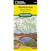
- Manti-La Sal National Forest Map (National Geographic Trails Illustrated Map, 703)National Geographic Maps - Trails IllustratedMap
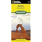
- Arches National Park Map (National Geographic Trails Illustrated Map, 211)National Geographic Maps - Trails IllustratedMap
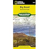
- Big Bend National Park Map (National Geographic Trails Illustrated Map, 225)National Geographic Maps - Trails IllustratedMap
From the Publisher


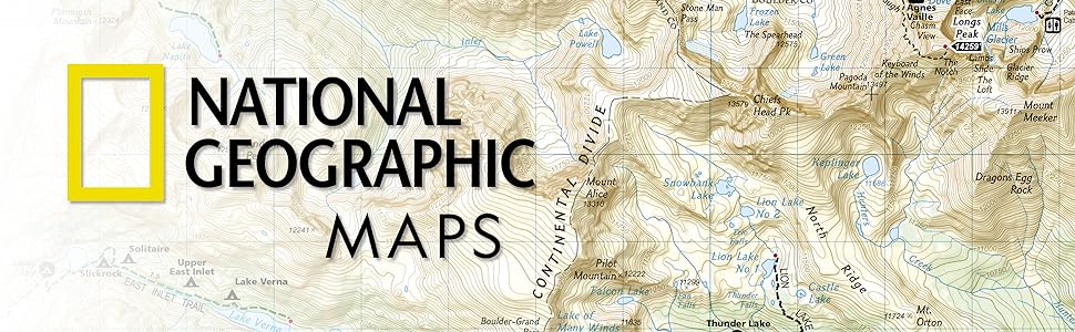
National Geographic Trail Maps – An essential tool for exploring America’s top National Parks
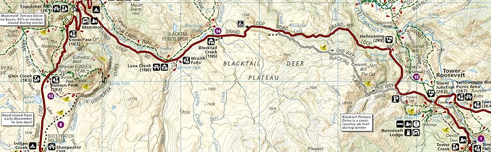
National Geographic’s line of Trails Illustrated maps includes detailed topographic trail maps for all of America’s top National Parks. Featuring updated and easy-to-read trail networks, important points of interest, and the key recreation information needed to make your next National Park visit an adventure.
National Geographic and the National Parks share a deep legacy dating back to the publication of an entire issue of National Geographic Magazine in 1916 titled 'Land of the Best'. That issue helped advocate for the creation of the National Park Service, later that year. Over the years, National Geographic has helped establish, preserve, or restore Sequoia, Katmai, Carlsbad Caverns, Shenandoah, Mesa Verde and Redwood National Parks. It has also publicized the parks through at least 500 books, articles, and maps, not to mention dozens of television documentaries.
Backcountry Tough
- Waterproof
- Tear-Resistant
- Nearly Indestructible
- Detailed Topography
- GPS Compatible With full UTM Grid
![]()
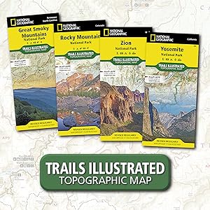
Great Smoky Mountains National Park
|
![]()
Zion National Park
|
![]()
Rocky Mountain National Park
|
![]()
Yosemite National Park
|
![]()
Yellowstone National Park
|
|
---|---|---|---|---|---|
Customer Reviews |
4.8 out of 5 stars 824
|
4.8 out of 5 stars 545
|
4.8 out of 5 stars 734
|
4.7 out of 5 stars 491
|
4.7 out of 5 stars 828
|
Price | $13.89$13.89 | $13.89$13.89 | $14.95$14.95 | $13.90$13.90 | $9.80$9.80 |
Yearly Visitors | 11.3 million | 4.5 million | 4.4 million | 4.3 million | 4.1 million |
Date Established | 1934 | 1919 | 1915 | 1890 | 1872 |
Miles of Trails | 820 miles | 88 miles | 431 miles | 782 miles | 1,021 miles |
State | North Carolina, Tennessee | Utah | Colorado | California | Wyoming, Montana, Idaho |


Product details
- Publisher : Natl Geographic Society Maps; 2020th edition (April 3, 2020)
- Language : English
- Map : 2 pages
- ISBN-10 : 1566954932
- ISBN-13 : 978-1566954938
- Item Weight : 3.21 ounces
- Dimensions : 4.1 x 0.7 x 8.9 inches
- Best Sellers Rank: #141,147 in Books (See Top 100 in Books)
- #170 in West Mountain United States Travel Books
- #260 in Maps (Books)
- #323 in Hiking & Camping Excursion Guides (Books)
- Customer Reviews:
Customer reviews
- 5 star4 star3 star2 star1 star5 star94%6%0%0%0%94%
- 5 star4 star3 star2 star1 star4 star94%6%0%0%0%6%
- 5 star4 star3 star2 star1 star3 star94%6%0%0%0%0%
- 5 star4 star3 star2 star1 star2 star94%6%0%0%0%0%
- 5 star4 star3 star2 star1 star1 star94%6%0%0%0%0%
Customer Reviews, including Product Star Ratings help customers to learn more about the product and decide whether it is the right product for them.
To calculate the overall star rating and percentage breakdown by star, we don’t use a simple average. Instead, our system considers things like how recent a review is and if the reviewer bought the item on Amazon. It also analyzed reviews to verify trustworthiness.
Learn more how customers reviews work on AmazonTop reviews from the United States
There was a problem filtering reviews. Please reload the page.
- Reviewed in the United States on November 15, 2024Map was in good shape, it was good clear map
- Reviewed in the United States on October 11, 2016Excellent map, great info on the back.
- Reviewed in the United States on April 19, 2016great guide - very useful